Google Maps – The Danta Torbiere
I return to complete the set to Danta, and pleasantly cross its surroundings again adding two aerial shots. The Torbiere of Danta from Drone Very interesting from the point of view of aquatic flora...
![]()
..dedicated to those who are not and who can no longer go
I return to complete the set to Danta, and pleasantly cross its surroundings again adding two aerial shots. The Torbiere of Danta from Drone Very interesting from the point of view of aquatic flora...

Stunning shots taken by my drone depicting the set of small valleys that form the Comelico valley and some nearby valleys Frison Valley Sesis Valley Ansiei Valley Piova Valley Melin Valley Digon Valley Grande...

First real high altitude excursion for this 2021 season. Departure from Pian delle Bombarde at Baita Rododendro. We first reach the Olbe Lakes which we still find covered with snow, then we climb Mount...

Simple afternoon outing on Mount Spina. Leaving just above Casamazzagno in the locality of Le Federe, we set off towards the north following the CAI-147 signpost. In short we reach the 1967msldm of Mount...

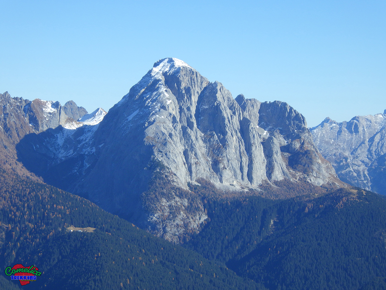
The Geographical Characteristics .the Peaks Monte Rinaldo is the highest peak of the Rinaldo-Ferro mountain range, reaches 2473 m a.s.l. and is clearly visible from the front as you enter Val Comelico from Cadore....
The Geographical Characteristics .the Peaks Monte Peralba with its 2649 m a.s.l. is among the highest peaks of Comelico. Together with the Col di Caneva and the non-Comelian Monte Chiadenis it forms the Peralba...

Today sunbathing towards the sources of the Piave. Once in Visdende Valley we leave the car in Sesis and go up to Pass of Caneva Hill by the mule track marked CAI-137, first in...

The Geographical Characteristics .the Summits Monte Terza Media and its two sisters Terza Piccola and Terza Grande make up the mountain group of the Terze. The Terza Media rises between the other two, attaching itself...

Today we try a simple and usually not very tiring climb. Starting a little further below Hut of Londo we went up the Londo Valley up to the Palombino Pass at an altitude of...

Today we visit the Digola Pass starting from the Mare locality of San Pietro di Cadore, then going up the Mount Terza Piccola on its north side. We start crossing the Piave river on...