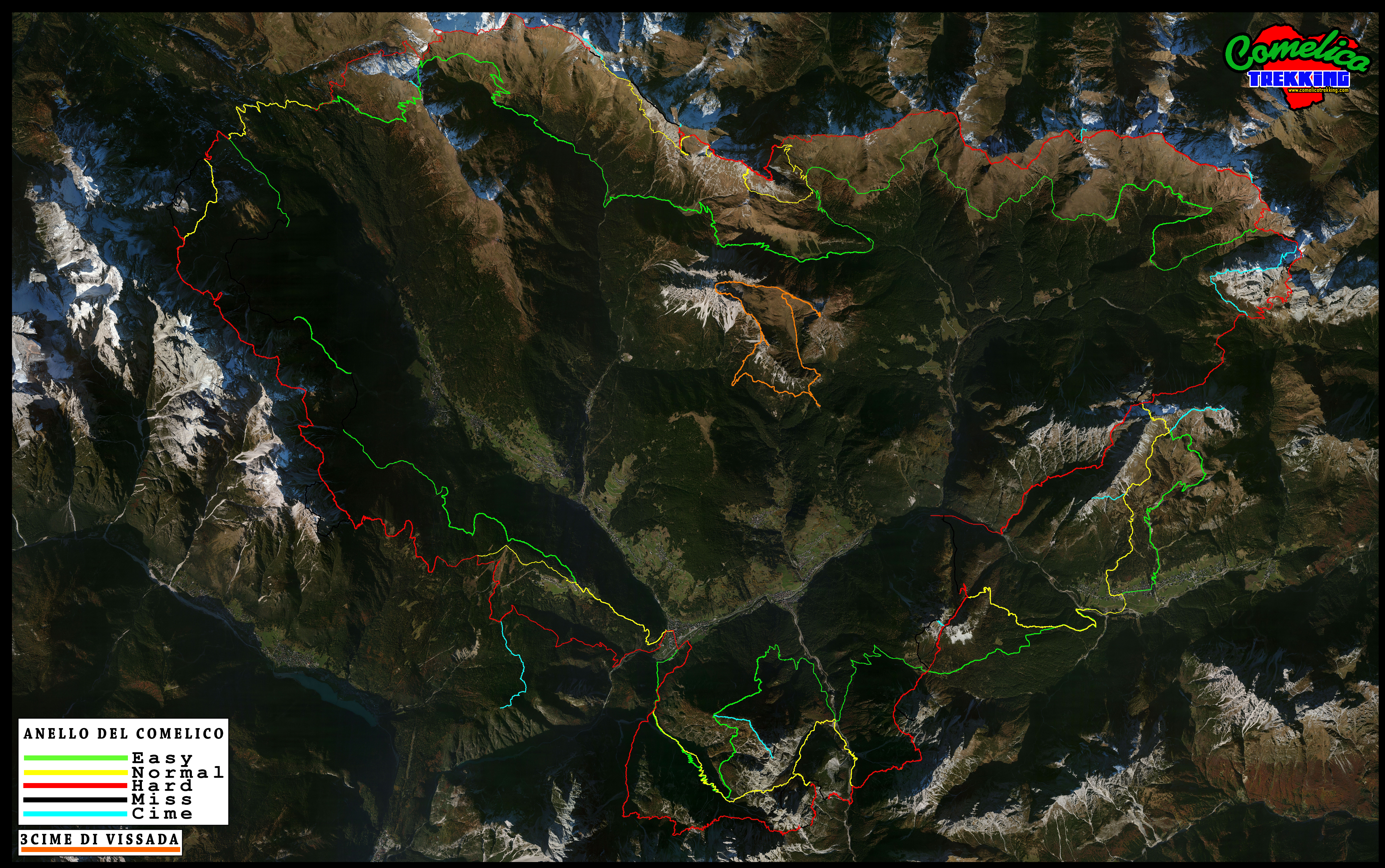
2020
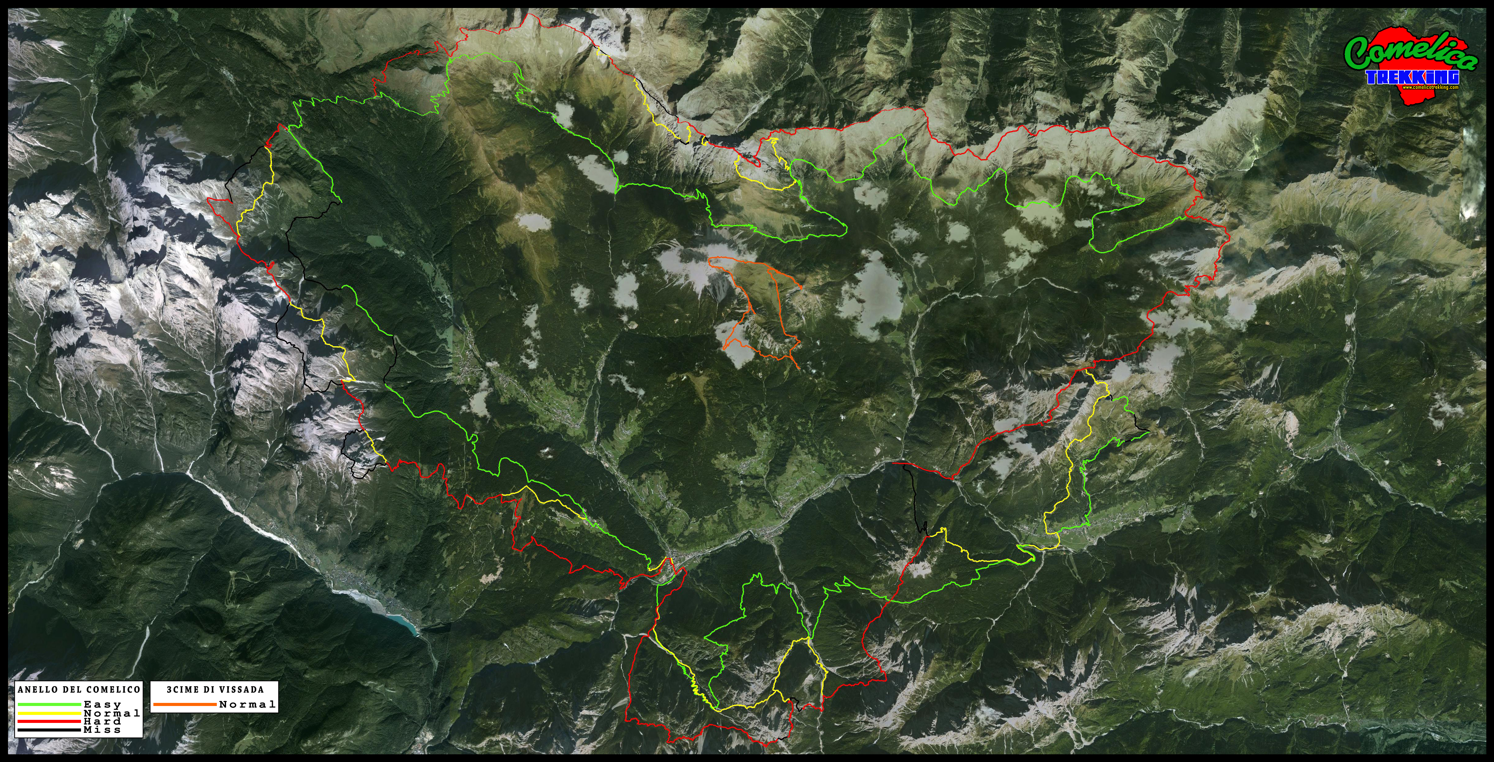
2017

The situation of my satellite tracking in 2017. The image below shows the Comelico taken from an aerial photo © Microsoft 2012 Livel 16. I extrapolated it to a height of 1000m (4158 x 2606px – 11MB)
It is also available qui the same image but in high resolution from a height of 400m (10346 x 6597px – 57MB)
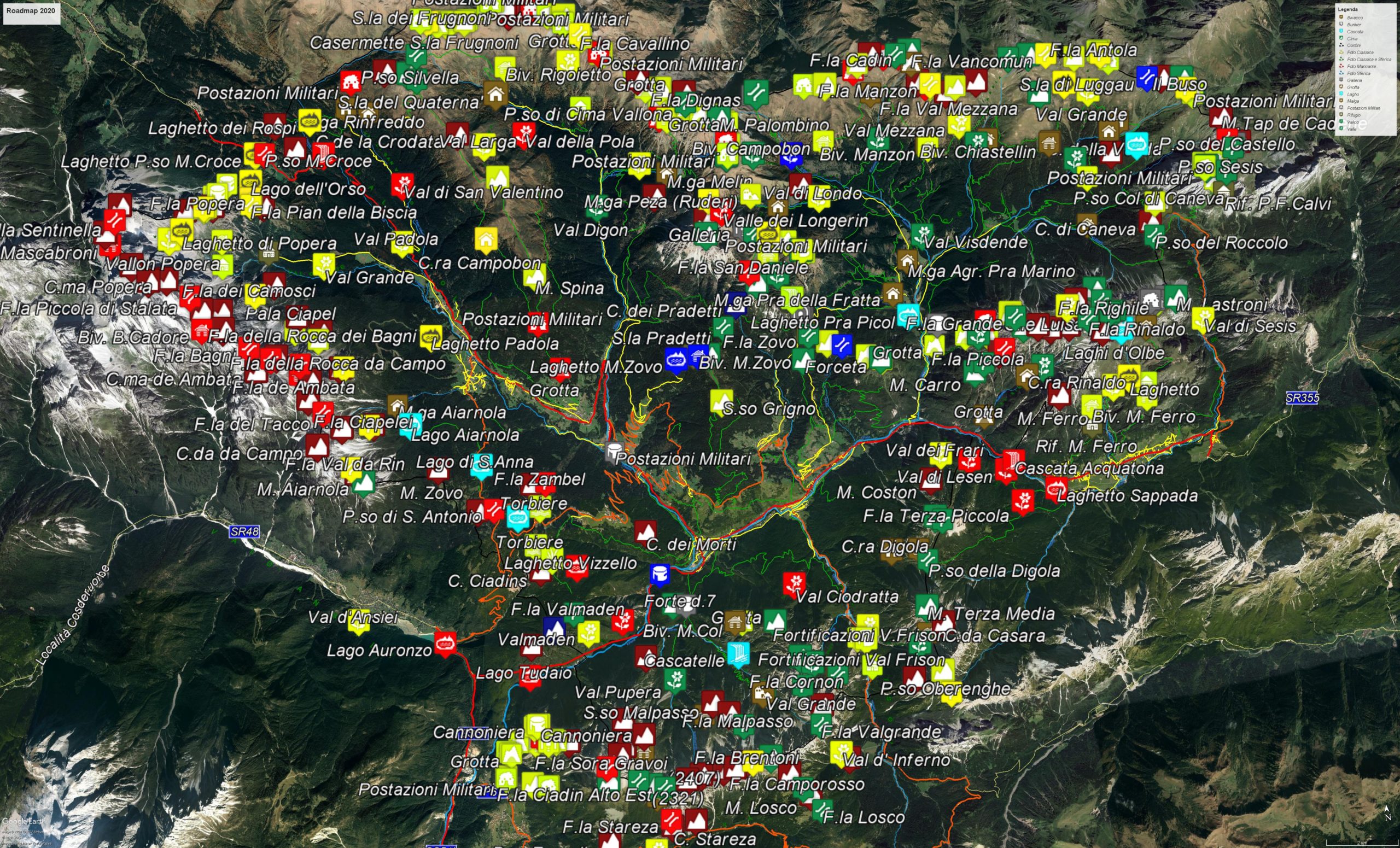
- Approach carriage roads have been added in white
- Added various “Hot” points such as the CAI-334 path, La Ferrata Dambros, The Frari Valley
- Some imperfect traces have been replaced along the group of Mt.Rinaldo
2016
2015