- Val Vissada Tour Preview
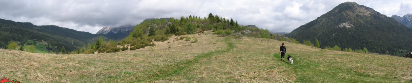
 After the last aerial shot of Val Vissada and the interiors of the bivouac, I sketched out a tour of the area including peaks, valleys and shelters. Still far from the final result in...
 - Upgrade of Peaks Waypoint PageI continue to upgrade the pages containing panoramic photos of the various points of interest present in Comelico. At the moment the beating heart of ComelicoTrekking which illustrates the key places of the valley...
- 3 New Mounts SheetsThe publication of: a Mountain sheet for each group of mountains present in Comelico has been completed. To complete the review I add the files of Col Quaterna’ which represents the Spina Group, of...
- The Fished OutI audience some shots to replace the previous ones, who had been captured at the beginning, when the necessary experience with the machine was missing and therefore were in low resolution or in some...
- New Content SoftwareImportant upgrade for the website: Pano2VR. Powerful software to manage panoramic images and 360 ° videos. This application allows me to improve the quality of the photographic shots and to speed up the workflow...
- Google Maps – The Mount Peralba from Oregone PassToday we visit Monte Peralba, the highest peak of the lower Comelico along a stretch of the Carnic crossing. Leave the car shortly after the Malga Chivion and go up towards the Passo dell’Oregone...
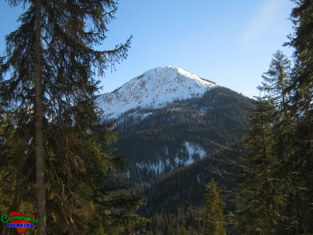
- Google Maps – Mount ZovoVery central mountain that welcomes most of the lower Comelico villages on its slopes. It arrives at the altitude of 1920 MsLdM. Grassy summit overview that can be gained from 3 different routes. Climbed...
- Google Maps – The Quaterna’ HillSimple loop excursion on Col Quaterna ‘which brought us to the altitude of 2500 meters above sea level of the summit which in time of the First World War was the scene of bloody...
- Street View – The Rock over ColeseiWonderful autumn day that gave us an easy and equally rewarding excursion. We leave at the Italo Lunelli Refuge in Padola. We go up to the Rock of Colesei along a comfortable cart track...
- Google Maps – The peak of Mount Cecido and Top of Manzon’s SalvadesLong circular walks starting from Val Visdende which took us on a splendid sunny day to travel my favorite Val Cecido. Going up the path without signposting, we reached Malga Cecido where I was...
- Google Maps – On Mount Cavallino from RigoiettoThis Sunday great ride on Mount Cavallino. Alternative departure from Malga Silvella. We go up along the hairpin bends that lead to Silvella Pass until we cross the CAI-146 path which heads east leading...
- Google Maps – The Antola ValleyAfternoon ride along the splendid Val di Antola. Cloudy day almost autumn that gave me two great photos. I then went up the new Costa Bruna forest road. The Antola Valley Visdende Valley –...
- Google Maps – Peak of Mount Col and Mezzodi’s RocksStrenuous climb that takes us to 2300 meters above sea level of Crode di Mezzodi, passing through Monte Col. We start from Santo Stefano di Cadore facing Monte Col from its north side starting...
- Google Maps – Peak of Mount Terza MediaExcellent autumn climb, summit not for everyone with climbing stretch and various exposed passages at the end. Drone videos have also been added. Peak of Mount Terza Media from Drone
- Google Maps – The Little Forks Valley and Mount RinaldoFirst summer release of this 2021 takes me to complete the drone shooting of this beautiful valley and the peak that dominates it. Rocket, Orbit and Pan videos also added. The Little Forks Valley...
- Vissada’s Valley UpdatesCopious update to the mountains overlooking the beautiful Val Vissada. San Daniele New track of the Via Sud with a more scenic route Waipoint of the Ferruccio Casanova equipped path Spherical photo of the...
- Google Maps – Mount Brentone East PeakThis time we go to Monte Brentone, the main peak of the homonymous group. Climbed from the not aided via Sud we cut the dihedral to the right until we reach the ridge that...
- Google Maps – The Danta TorbiereI return to complete the set to Danta, and pleasantly cross its surroundings again adding two aerial shots. The Torbiere of Danta from Drone Very interesting from the point of view of aquatic flora...
- Google Maps – Comelico Valleys and aroundStunning shots taken by my drone depicting the set of small valleys that form the Comelico valley and some nearby valleys Frison Valley Sesis Valley Ansiei Valley Piova Valley Melin Valley Digon Valley Grande...
- Google Maps – The Mount LastroniFirst real high altitude excursion for this 2021 season. Departure from Pian delle Bombarde at Baita Rododendro. We first reach the Olbe Lakes which we still find covered with snow, then we climb Mount...
- Google Maps – The Mount SpinaSimple afternoon outing on Mount Spina. Leaving just above Casamazzagno in the locality of Le Federe, we set off towards the north following the CAI-147 signpost. In short we reach the 1967msldm of Mount...
- Google Maps – The Caneva Hill and The Source of Piave RiverToday sunbathing towards the sources of the Piave. Once in Visdende Valley we leave the car in Sesis and go up to Pass of Caneva Hill by the mule track marked CAI-137, first in...
- Google Maps – The Palombino PassToday we try a simple and usually not very tiring climb. Starting a little further below Hut of Londo we went up the Londo Valley up to the Palombino Pass at an altitude of...
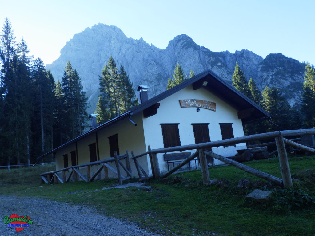
- Google Maps – The Military Ambush Ronco del PopoToday we visit the Digola Pass starting from the Mare locality of San Pietro di Cadore, then going up the Mount Terza Piccola on its north side. We start crossing the Piave river on...
- New Video SectionAdded a new VIDEO section to the site. After trying a few different video gallery plugins I was satisfied with the current one. It allows a good responsive flexibility and a high personalization. It...
- Google Maps – Peak South of Longerin’s RocksWonderful autumn day for a trip to the Longerin’s Rocks. We went up along the unknown Southern way which, instead of going up the mountain along the right side of the arena like the...
- Google Maps – Mount della PianaQuick ride in Sappada. Going up along the ski slopes, I first reached Refuge 2000, then along the nature trail No. 4 I went back down towards the town. Small stop to admire the...
- Spherical with the droneAfter the mandatory bureaucratic part, necessary to be able to fly safely and in compliance with the law, I publish the spherical photos captured recently. Initially, the result was not exactly exciting! After some...
- Google Maps – The Mount CarroDeparture from below, near the tunnel next to the abandoned Salafossa mine. Strenuous climb along the steep road on the CAI-143 trail that winds mainly through the woods along an old mule track at...
- Updates for Mount Curie’ MapNew contents for the map of Monte Curie’, two spherical photos of the shelters near the top The Gallery on Mount Curie’ Inside The Gallery on The Peak of Mount Curie’ New video of...
- Advertising insertionFor a long time I have been struggling to insert advertising within Comelicotrekking. I believe that this practice, if abused, is really frustrating for the average navigator. That’s why I evaluated the least invasive...
- New User: DJI Mavic AirAfter months of careful evaluations, I decided to expand the Comelicotrekking instrumentation by purchasing a flamboyant DJI Mavic Air also thanks to the collapse of the price due to the generational change. Little gem...
- New 3D TOUR Mount Terza MediaAfter the map page, the TOUR with Google Earth of Monte Terza Media is also available, available for download in high resolution here ‘. Spherical videos of the descent divided into two parts are...
- New Map: Mount Terza MediaThe new map of Monte Terza Media is almost ready, a short tour, download, spherical video and complete Monte card.
- Google Maps – The Mount Terza GrandeThird and last Spherical for the group of thirds, the highest of the three is completed with Mount Terza Grande with a sun and rock bath. The Oberenghe Pass The Peak of Mount Terza...
- New Hike Card: On Mount San DanieleNew excursion card on Monte San Daniele, reviewed the alternative climb from the south to the entrance of Val Vissada, steep and wild route that quickly leads to the top of the mountain. It...
- Google Maps – The Mount CavallinoThe panoramic photos of Comelico Trekking also arrive in Granda Valley and the overlying Mount Cavallino. Popular destination of the Comelico valley also by foreign tourists, thanks to the friendship path and a simple...
- New Map LayoutFurther update to the layout of the site maps. Moved the command, download and statistics tables down for better usability on mobile devices. However, the site remains mainly usable on desktop computers.
- 360 ° Videos of the DescentsThe first videos of the descents from the Comelico peaks have been published today. Currently available these three, many others will follow.
- The Mount BrentoneEven the Monte Brentone reviewed on Comelicotrekking is ready for the description, the tour on Youtube or in high resolution from the site the Map for Google Earth or just the list of POIs...
- Google Maps – The Colender of Mount PuperaNice route to pass on the colender of Mount Pupera of Valgrande that goes from Fork Stareza to Fork Camporosso in the territory of the municipality of Vigo di Cadore. The Fork Stareza The...
- Google Maps – The Fortifications in Frison ValleyStreet View also arrives at the fortifications of the First World War in Frison valley, after all this time the tunnels and bunkers are still closed for too long .. When will an opening...
- New 3D Tour – The Mount BrentoniThe new presentation recorded by Google Earth of Monte Brentoni is ready. You can see it on Youtube at this address. The website has a high definition version with this link (Registration required). It...
- Google Maps – The Valgrande ForkAn alternative way to reach the Valgrande fork of Santo Stefano is to start at the Peak of Ciampigotto valley and walk north, first crossing the Losco fork and then The Camporosso fork, at...
- Google Maps – The Rementera HillFirst shot of 2024, we visit Casera Razzo before the spring exercises, which close all the airspace in the area. Still covered in snow, the area allows us an excellent view of Piova Valley....
- Maps UpdatesAdded new icons following the new preset theme: – Red Waypoints without photos –Yellow Waypoints with flat photo only –Blue Waypoints with only the spherical photo –Other colors waypoints with all photos Completely redone...
- Google Maps – The Misurina LakeFour years after my last spring visit, I return to complete the set and take a wonderful summary photo of the future VR Tour of Lake Misurina with the drone. Always a well-trafficked destination...
- Google Maps – The Pond of Mount Croce Comelico PassPassing to The Mount Croce Comelico Pass you come across this suggestive artificial pond located next to the homonymous Hotel.
- Google Maps – The Acquatona RavineAfternoon stroll – just right to digest- in the Ravine of the Aquatona. Unfortunately closed because unsafe. In evidence the disaster of the post Vaia tempest to the forest. The Bridge that Crosses The...
- New Header ImagesGiven the recent change of theme to the site I add ten new head images this time taken from the spherical photos. Instead these are the old header images. Coming from the previous layout...
- Comelicotrekking Become MultilingualAfter 2 weeks of unbridled copiaincolla I completed the translation of the site in English and German to be more friendly towards all our friends across the border, hoping to collect visits from foreign...
- Google Maps – The Comelico LakeFinally after 4 attempts I manage to capture the Comelico Lake or Tudaio Dam full and full. The walk along the Old Valley which runs from Cima Gogna between Mount Tudaio and Mount Piedo...
- Google Maps – The Auronzo LakeExcellent day to add some overview of the Comelico surroundings. On the Auronzo Lake Dam Along the Pedestrian Bridge that Crosses the Auronzo Lake in the Center Along the Car Bridge that Crosses at...
- Google Maps – The Lake of Centro CadoreIt has little to do with Comelico and even less with trekking, but I think it is of great interest to any tourist in the area. The Lake of Centro Cadore from Drone –...
- 5 Years of ComelicotrekkingA bit of history 5 years have passed since the first post on Comelico Trekking, a lot of work has been done, the site was already in prototype format for a year, a format...
- Google Maps – The Comelico water coursesPublic some spherical lakes of various sizes present in Comelico valley wonderful places of relaxation The Pissandola waterfall The Mount Col Little Waterfalls The Hill of Varda Pond The Great Olbe Lake The Little...
- Google Maps – The Great War in ComelicoCopious updating of spherical images concerning the First World War in a Comelico abundant presence of forts, bunkers, trenches and various fortifications unfortunately now in a very bad state of conservation. The gunboat of...
- Google Maps – The Comelico SheltersSome spherical ones concerning the Comelico shelters are online The Tunnel Through The Torrioni of Longerin The Gallery in Mount San Daniele Cave on Mount Cecido Rinaldo Valley Shelter
- UpdatesThe construction of the maps of the Points of Interest for excursions / Trekking in Val Comelico continues. In this episode I have added the photogallery of the bivouacs available at this address, also...
- Google Maps – The Bivouacs of ComelicoStreet View images regarding the Comelico bivouacs are also ready online The Mount Col Bivouac The Ursella Zandonella Bivouac The Federa Mauria Bivouac The Spagnolli Bivouac The Franco Marta Bivouac The Digola Bivouac The...
- New POI Map of the RefugesFinally, I also added the map of the refuges in Comelico that can be viewed at this address. While all ten flat images of the buildings are available, there are only 5 panoramic photos,...
- Google Maps – The Comelico RefugesAlso online the sphericals for Street View regarding the Comelico refuges: The Italo Lunelli Refuge The Mount Ferro Refuge THe Mount Zovo Refuge The Zovo Fork Refuge The Piave River Source Refuge The Pier...
- New Refuges PhotogalleryThe new photogallery of the Comelico refuges can be seen at This address, 10 images that herald the next POI map together with the relative panoramic images available. New preview BOX also on the...
- Peaks POI UpdatesCopious update for the map of the Comelico peaks. New features include the following flat photos: Also added some new 360 ° panoramic images:
- The Legend of RinaldoOnline the Tale taken from the book by Italo de Candido L’Anello del Comelico, entitled: The Legend of Rinaldo, a funny and curious story that tries to make sense of some names of mountains...
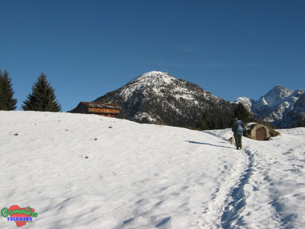
- Huts POI UpdatesSmall updates to the map of the points of interest relating to the Comelico huts. Normal Photos: Spherical Photo: The Digola Hut The Rinaldo Valley Hut The Pra Marino Hut / Restaurant The Pra...
- Google Maps – Mount AiarnolaI add to the spherical images for Google Street View the photo of the top of Moun Aiarnola, which is not a very simple peak due to the unstable rock. EDIT 2022: Climbed from...
- Google Maps – The Mount BrentoniComplete card of the mount available here The Losco Fork The Camporosso Fork The West Peack of Mount Brentoni
- Google Maps – Mount Curie’Simple but rewarding top of 2035msl. Central location. Complete card of the mount available here The Forcetta The Mount Curie’ Peak The Mount Curie’ Peak with Snow
- Google Maps – The Mount PeralbaAscent to Mount Peralba along the normal route dedicated to Giovanni Paolo II with CAI-132-131 simple ascent with some exposed sections in which to be careful. Crowded and very panoramic peak. We went down...
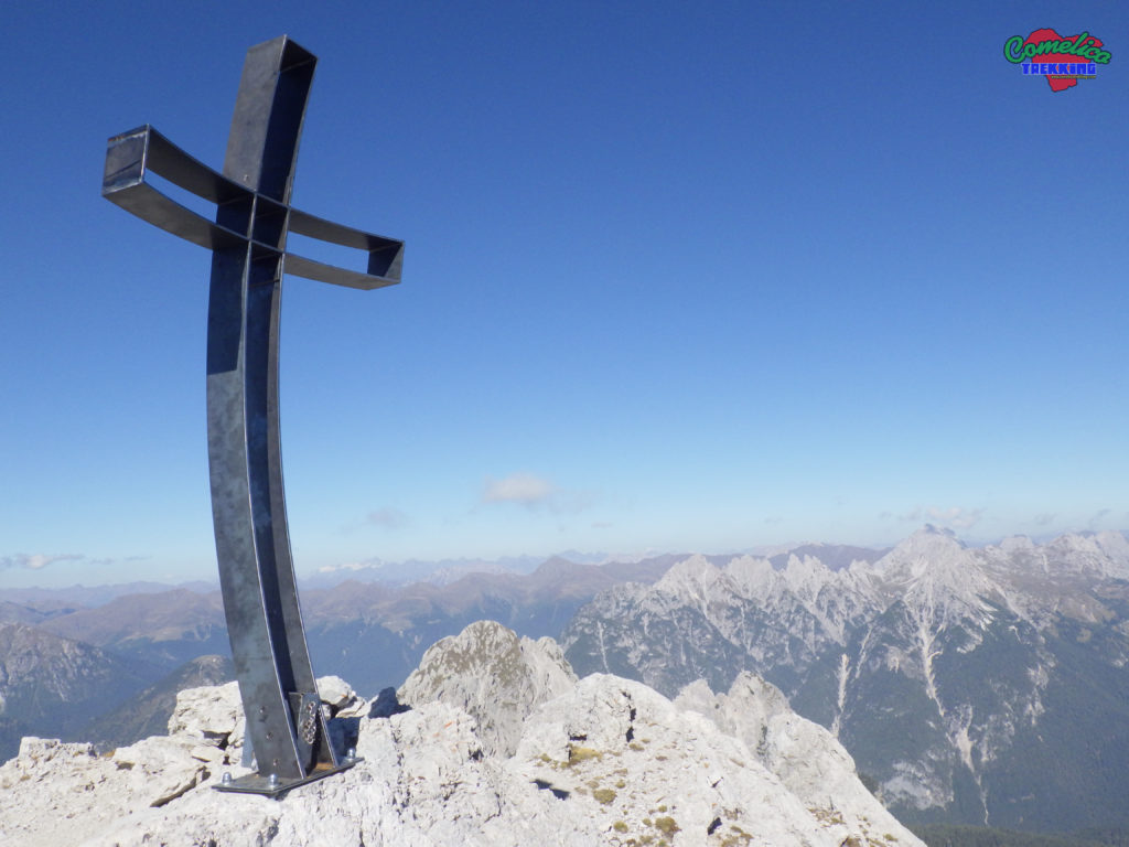
- Google Maps – The Mount Terza MediaMount Terza Media, in the opinion of many, is the wildest and most difficult of the Tree Terze. Climb up the CAI path with trail marker 310 which starts from the Cadore-Feltre Alpine Volunteer...
- Google Maps – The Rinaldo Valley and Mount FranzaLong tour starting from the Regional 355 for Sappada, go up the Rinaldo valley along the CAI-193 path and taking the Righile fork on the right you go down to the Franza saddle through...
- Google Maps – The Hill Quaterna’Wonderful walk at high altitude that runs through the upper part of the Digon valley. We start from Silvella Hut and go up the valley to Silvella Pass along a wide panoramic mule track...
- Google Maps – The Mount RinaldoThe Little Fork of Mount Rinaldo The Peak of Mount Carro The Forcellette Valley The Great Fork of Mount Rinaldo The Peak of Mount Rinaldo
- Update POI Map The Alpine PastouresThe map of the POIs of the Comelico huts has been updated by placing the colored icons following the sequence of the map of the POIs of the peaks Added the M.ga of Vissada,...
- FotogalleryI added the Photogallery Plugin and now Comelicotrekking begins to have the shape it has in my thoughts .. Lately the number of photos has increased considerably so much that a way is needed...
- New POI Map – The Peaks of ComelicoThe brand new map with the Points of Interest of the Comelico peaks is finally available online at this address. In red the peaks that do not have a photo, in yellow the peaks...
- Google Maps – The High CadinsThe Pupera Valley The High Pupera Valley The High Cadin West Fork In The Middle of High Cadins The High Cadin Est Fork
- Changes CompletedFinally completed the update process in the kml files on the site. Now all the images in the balloons no longer point to Panoramio but directly to the WordPress library, ditto all the objects...
- Google Maps – The Cornon ForkThe High Great Valley The Great Valley Fork The Mount Cornon Saddle The Cornon Valley The Cornon Fork
- Google Maps – The Malpasso ForkThe Baiarde Camp The Pupera Valley The Malpasso Fork The Drota delle Pere Hut Ruins In The Middle of Great Valley
- UpdatesI fixed the links to the pages by removing some superfluous signs and replaced the links to the youtube videos that were not correct. Now all pages are called together without errors. All the...
- Google Maps – The Mezzodi’ RocksThe Planes of Gei The Crossway on Mount Col Pra Grande The ePeak of Mount Col The Peak of Mezzodi’ Rocks
- Google Maps – To The Olbe Lakes and Mount LastroniThe Olbe Hut The Great Olbe Lake The Peak of Mount Lastroni
- Google Maps – The Vissada ValleyComplete Cards of The Mounts in Vissada Valley: The Longerin’s Rocks The Mount Schiaron The Mount San Daniele The Zovo Fork The Little Waterfall of Pisandui The Vissada Valley The War Memorial in Vissada...
- General UpgradeOnce the transition to the secure https protocol has been completed, the whole site is now “clean” and aligned with current regulations, except for the webcam part which “steals” external links not protected by...
- Google Maps – VariousThe Peak of Hill Torondo The Peak of Mount Schiavon The Peak of Grigno Rock with The Snow The Roccolo Pass in Winter To The Sources of Piave River in Winter The Sources of...
- New 2017 RoadmapFinalmente ho pubblicato il punto della situazione per quanto riguarda la tracciatura satellitare “globale” della Val Comelico per l’anno 2017. Puo’ essere consultata non piu’ in home page ma in un suo spazio dedicato...
- Google Maps – The Mount CecidoThe Cecido Valley The Cecido Fork The Peak of Mount Cecido
- Google Maps – The Mount PiedoAnother simple peak with a very panoramic view of the Comelico villages … The Valmaden Fork The Peak of Mount Piedo from Drone The Peak of Mount Piedo The Peak of Mount Piedo from...
- Google Maps – The Mount ZovoVery central location in Comelico The Crossway on Mount Zovo The Peak of Mount Zovo
- The Firsts Google Maps – The Comelico HutsHere are the first spherical images published by comelicotrekking on streetview The Rinaldo Hut The Sesis Hut The Chivion Hut The Chivion Hut in Winter The old Antola Hut Ruins The Antola Hut The...
- The Samsung Gear 360Finally my 2016 Samsung Gear 360 has arrived … Google Maps / Street View get ready !!
- New RoadmapUpdated the image on the Home Page that represents the satellite tracking for 2016 and a high resolution image from a height of 400m is available here
- The Mount Curie’Once the page dedicated to Mount Curie’ has been completed, the description and relative photos have been added. Available here
- The Virtual Tour of Mount Curie’The Virtual Tour built with Google Eath has been completed and published. my channel YouTube or download in High Definition Here Enjoy!
- New Changes to the SiteRedesigned the layout of the frame with the map to improve its usability Spostata la tabella con i controlli sulla destra Moved the table with controls to the right the youtube video moved to...
- New Site Changes– New Login Page– Nuovo download system New improved method to register and authenticate on the site. provides automatic validation emails and password changes in a classic way. There is a link to log...
- Map Preview – Mount Curie’The draft of the next comelicotrekking map is semi-publicly online. It can be consulted in preview at this address. Missing to create the descriptive page with the photos and the video tour, the part...
- New Winter TimesThe timetables of the Dolomitibus lines have been updated by aligning them with those present on the official website. The timetable for the route Nr. 440 S. Stefano-San Candido remains unchanged until 10 December.They...
![]()
..dedicated to those who are not and who can no longer go