Google Maps – The Mount Palombino Pt.2
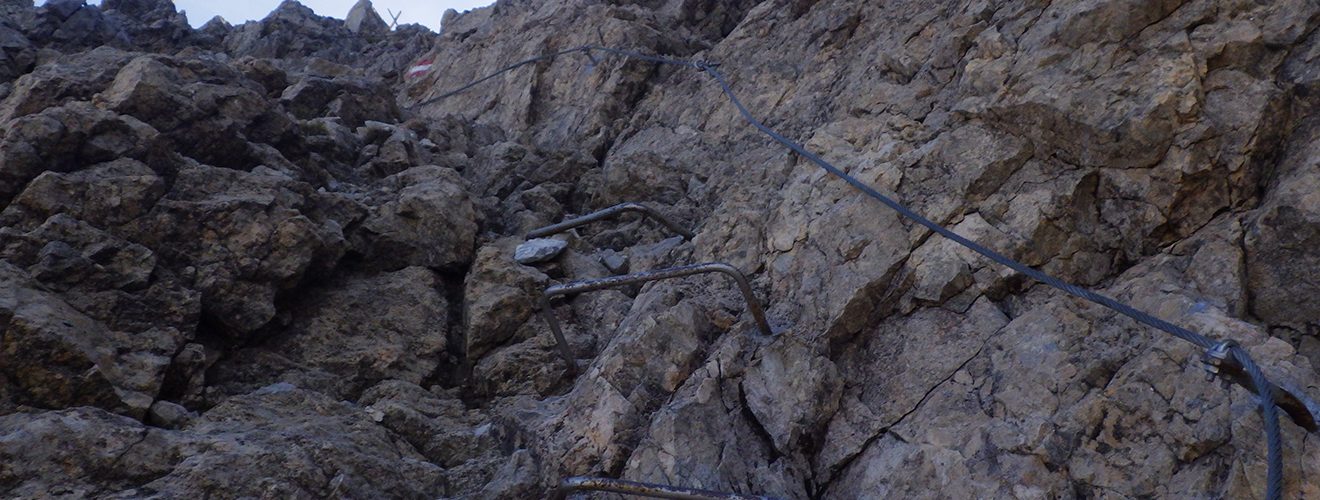
Another appointment in the high mountains in Comelico, this time we return to Mount Palombino along the Ferrata del Camoscio which faces the mountain from its east side. It starts shortly after Malga Dignas going up the cart track that leads to fork of the same name, CAI-170. Shortly before reaching the top on a hairpin bend on the left, we leave the road traveled up to now and take the CAI-172 path that will take us to the top. The chamois via ferrata runs along the rocky side of Mount Palombino mainly along a ledge that cuts it towards the east until it reaches the ridge. Once you reach the grassy side of the mountain, you will soon reach the top. We return to the normal route with the CAI-142 trail and then descending the Palombino Valley on the 142a trail. There is a rich presence of remains of the First World War such as barracks, tunnels, caves and various walkways in fact the mountain was often disputed between the two opposing factions.